Drone facade inspections for London buildings
Every elevation captured close up, defects found by AI and checked by an inspector, then pinned to a 3D model of your building. No scaffold, no cradle, no road closures for the inspection.

Why survey a facade by drone
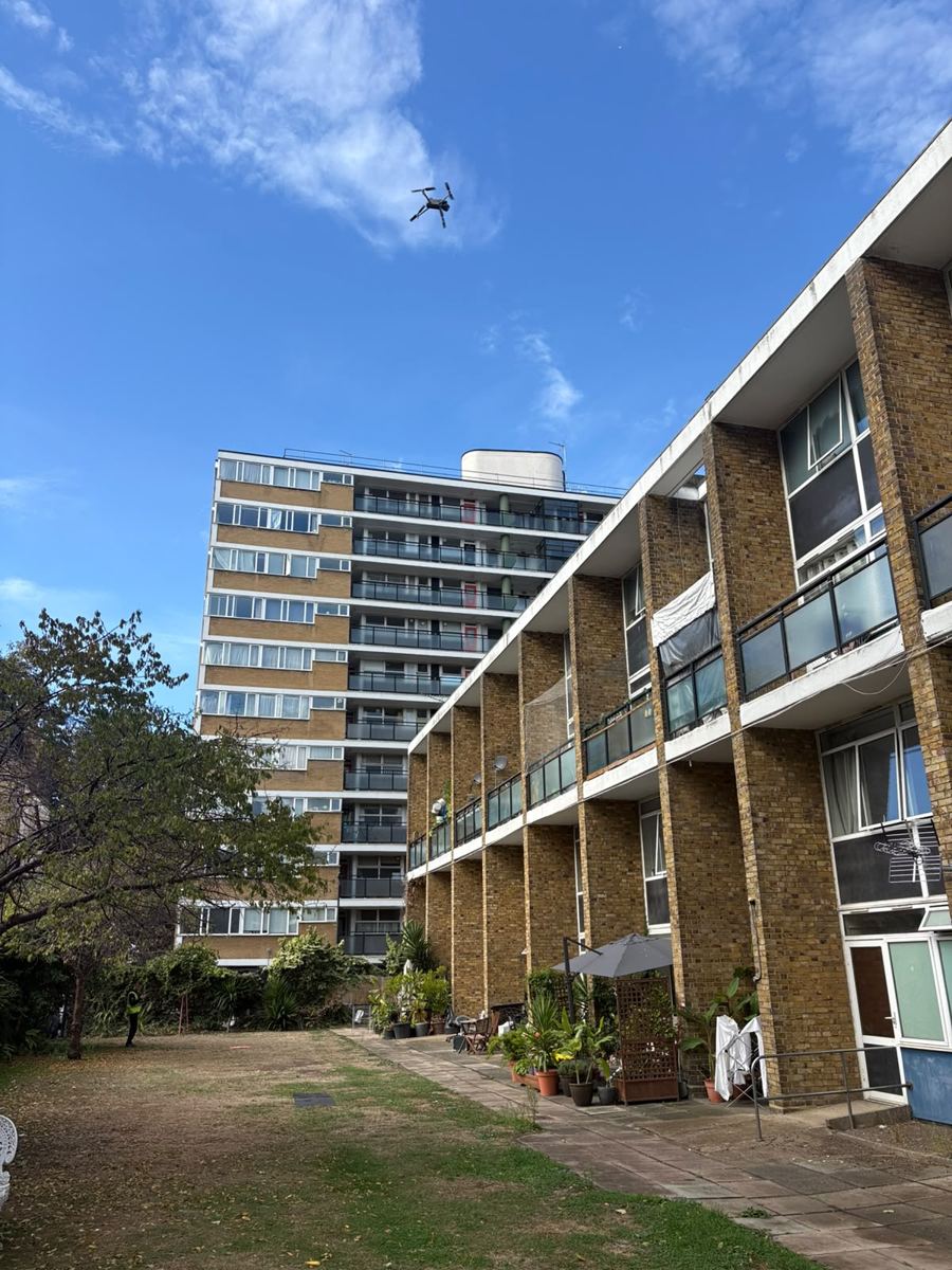
A traditional facade survey means scaffold, a mobile platform or abseilers, and often a licence to put kit on the pavement. That is days of set-up before anyone looks at the wall. A drone covers every elevation in one visit with a small take-off area, and photographs the whole facade rather than the patches someone could reach.
- Render and brickwork: cracks, blown render, spalling, open joints and failed repairs.
- Cladding and fixings: loose or missing panels, corrosion and movement.
- Windows and sealant: failed mastic, damaged glazing and frames.
- Falling-object risks: anything loose at height is flagged first so it can be made safe.
From images to a 3D model
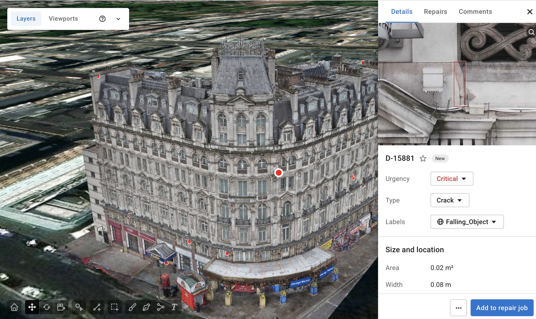
The survey images are built into a 3D model of the building. AI defect detection runs across thousands of frames, and an inspector who has worked on facades at height checks and grades every finding. Each defect is placed on the model at its exact spot, with its size measured from the model and the close-up image that found it.
Defects are then grouped into repair jobs that a contractor can price and plan from, so you go out to tender with a clear scope.
Who uses our facade inspections
Managing agents and freeholders planning major works. Hotels that cannot have scaffold across the front of the building. Housing providers checking blocks and towers. Surveyors and architects who need high-level imagery for their own reports. Facade and glazing contractors who want an accurate scope before they quote.
What can a drone facade inspection find?
Cracked or blown render, spalling concrete and brick, failed or missing sealant, loose cladding, corroded fixings, damaged glazing and staining that points to water getting in. Anything that could fall is flagged as a priority.
Do I get a 3D model of the building?
On larger facade surveys, yes. The images are built into a 3D model of the whole building and each defect is pinned to its exact position, measured and graded. Smaller jobs get a photo report instead.
Can you survey a building next to a busy street?
Yes. We have flown live streets in the West End. We plan a controlled take-off area with a ground team and keep the drone clear of the public throughout.
Is it legal to fly a drone over buildings in London?
Yes, when it is done under the right authorisation. 901 Aerial Surveys flies under a CAA operational authorisation (PDRA01), which covers commercial flights close to people and buildings. Much of London sits inside controlled or restricted airspace, so we arrange any permissions needed before the day.
Do you need access to my property?
Usually only a small, controlled take-off area, such as a car park, garden or a quiet stretch of pavement. Nobody needs to go onto the roof or into the building for the inspection itself.
What happens if the weather is bad?
Drones cannot fly safely in rain or strong wind, so we watch the forecast and move the flight if needed. We confirm the day with you beforehand.
Get a quote for your facade survey
Send the address and what you need to know. We come back with a survey plan, a price and any airspace permissions needed.